

Wharton
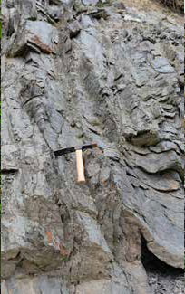
The Cobequid Fault that defines northern from southern Nova Scotia is so immense that it is difficult to see up close and personal. But along the roadside at Wharton, an exposure provides a close-up of the forces involved, where fine sedimentary rocks called siltstone have been changed under great pressure to shiny metamorphic phyllite, and deformed into sharp folds as the blocks of Pangea slid into place.
Geological Formation: Uncertain
Age: (of deformation) Carboniferous (circa 330 million years)
Directions: From Highway No. 2 at Crossroads, north of Parrsboro, travel west on Highway 209 for 4.7 km. Park on the gravel pulloff on the north side of the road.
Click for a Larger View

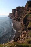 A Geopark is a designation that attracts tourists wishing to explore the connections between geology, local communities, culture, and nature. Geoparks are designed to promote tourism and celebrate a region’s uniqueness, and do not prohibit any land use.