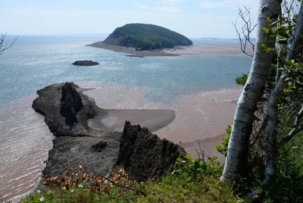
Isle Haute
Distant enough to be somewhat mysterious, Isle Haute is shrouded in sea mist and legends and is a rich sanctuary for seabirds and seals. Known as Maskusetkik by the Mi’kmaq, it was later referred to as Isle Haute by Samuel de Champlain who visited in 1604. Haute is French for high in reference to the cliffs of columnar basalt which tower 100 metres from the waters of the bay.
Geological Formation: North Mountain Formation
Age: Late Triassic-Early Jurassic (circa 200 million years)
GPS Coordinates: 45.250516, -65.002739
Directions: Isle Haute lies 8 km off Cape Chignecto in the Bay of Fundy and can be accessed by boat for day use only. Isle Haute is administered by the Canadian Wildlife Service of Environment Climate Change Canada for the creation of a National Wildlife Area. Best experienced from the water, visitors to the island should be mindful of disturbing wildlife especially during the nesting season.

Other Popular GeoSites


