GEO Heritage

Safety
Tips
GEO
Sites

Trails & More

Local
Food

Membership

Cape d’Or Lighthouse. Image courtesy of Megan Cameron
Cape d’Or
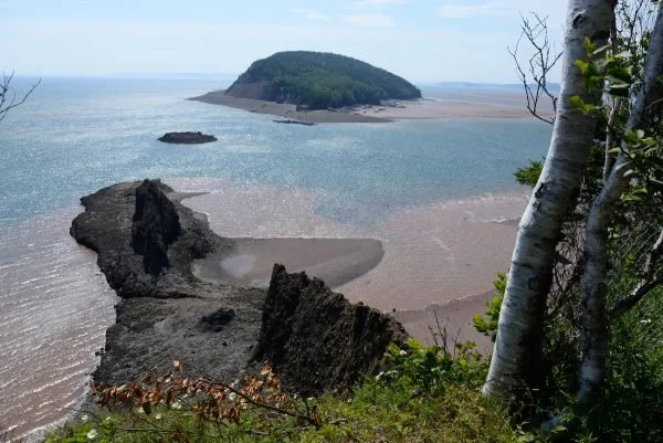
Towering cliffs of basalt extend out into the Bay of Fundy where a scenic lighthouse overlooks powerful tidal currents known as the Dory Rips. It is said that explorer Samuel de Champlain named this point Cap d’Or (Cape of Gold) in the 1600s because of the golden colour of the copper shining in the cliffs. For the Mi’kmaq, it was the veins of hard and dense agate found in these basalt cliffs, as well as the copper, that had great value for making sharp-edged tools like scrapers, projectile points and knives. They traded copper as far west as the Great Lakes.
Geological Formation: North Mountain Formation
Age: Late Triassic-Early Jurassic (circa 200 million years)
Directions: Take Highway 209 east of Advocate to Back Street. In about 0.5 km, turn onto Cape D’Or Road and go south 5.6 km to Cape d’Or lighthouse. Park at top where there is a viewing platform. If you choose, follow the steeply descending track to the lighthouse but stay back from the cliff edge at the bottom.
GPS Coordinates: 45.290726, -64.774116
Tide Times: http://www.tides.gc.ca/eng/station?sid=236
Ancestors Live Here Video Series: L’mu’julktuk: place of the dogs Cape d’Or on Vimeo
Tours
Cape d’Or by Boat - Local Guy Adventures
“Experience the Bay of Fundy like never before. Feel the rush of the tides as you take in incredible views of Cape d'Or, a Bay of Fundy landmark and home to a historic lighthouse.” - Local Guy Adventures


Other Popular GeoSites
-
![]()
Ward Falls
-
![]()
Five Islands
-
![]()
Three Sisters
-
![]()
Cape D'Or